Crusader Atlas
Interactive map of Crusader castles, towns, and fortifications in the Holy Land
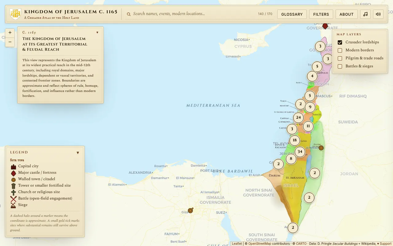
Crusader Atlas is a hand-curated interactive historical atlas mapping Crusader-era sites, fortresses, battles, and surviving remains across modern Israel, Jordan, Lebanon, and Syria. It covers the medieval Kingdom of Jerusalem and neighboring Latin states from 1099–1291, placing every castle, church, and battlefield on a modern map with detailed accounts and photographs. The project is free and ad-free, sustained by voluntary donations.
Users explore an interactive map with curated markers for castles, towns, battles, and religious sites, each containing historical accounts, Wikipedia links, and photographs of surviving remains.
history enthusiasts, researchers, and travelers interested in medieval Crusader history
Background.
- Status
- launched
- Business model
- free
Founders
- Yotam Katzsite
Similar projects.
Editorial take on the space this project sits in — momentum signals, adjacent moves, our call on whether the wedge is real. Get pinged when we publish a new read or when the landscape shifts.
Have a take on this space?
Tell us what you’d build differently, where you think the incumbents miss, or what we’ve gotten wrong about this project. Comments + reactions are coming soon.